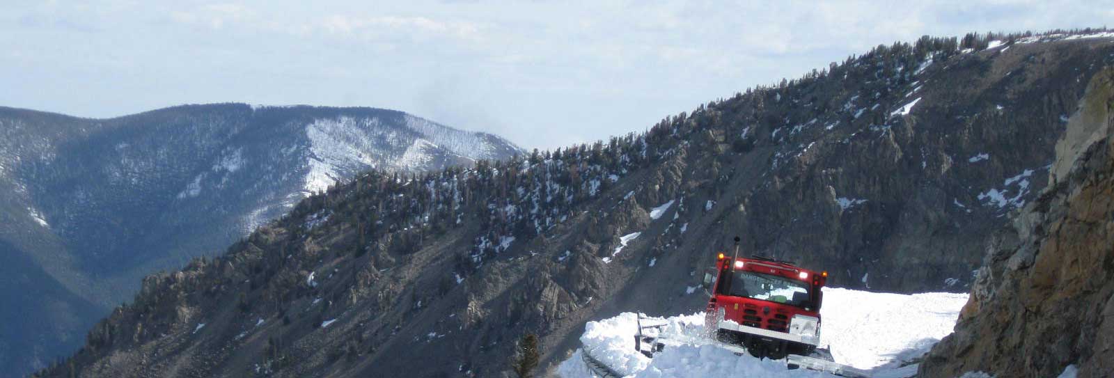
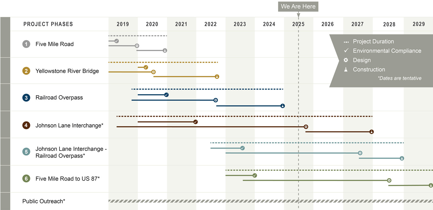
What is the schedule for the project? When will it be completed?
How much will the project cost?
The estimated project cost is broken down by project segment below.
| Five Mile Road: | $5.8M |
| Yellowstone River Bridge: | $32.5M |
| Railroad Overpass | $19.5M |
| Johnson Lane Interchange: | ~ $55.9M |
| Johnson Lane Interchange – Railroad Overpass: | ~ $8.0M |
| Five Mile Road to US 87: | ~ $14.8M |
| TOTAL | ~ $136.5M + I.C. |
Is the project funded?
Yes. MDT has identified funds for the entire project, which is divided into six phases to accommodate design and construction scheduling and funding needs.
What will the new road be named?
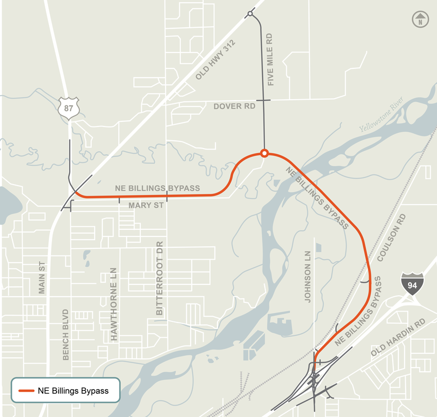
The new road connecting Johnson Lane Interchange and Main Street will be named NE Billings Bypass. The roadway that will have that name is illustrated in orange in the following graphic.
Why was this alignment chosen as opposed to other alternatives?
Several alternative alignments, or routes, were considered throughout the development of the Environmental Impact Statement (EIS) Record of Decision. Alternatives were evaluated against several criteria, including how well an alternative would meet the project purpose and need, community needs, construction and right-of-way costs, constructability, and traffic flow. After careful analysis, the alignment selected best fulfills project and stakeholder goals.
How many lanes will the new roadway be?
The roadway is being constructed as a two-lane road, with one lane in each direction. However, a four-lane version is also being designed to accommodate future expansion.
Will roundabouts be installed as part of this project?
Roundabouts are constructed on Five Mile Road at the intersections with Old Highway 312 and the new arterial road. The remaining project intersections will be controlled through signals or stop signs on the intersecting streets.
What will happen at Johnson Lane Interchange?
The Johnson Lane Interchange will be a Diverging Diamond Interchange (DDI), the first to be built in Montana. This style of interchange was selected after detailed traffic operations and geometric analysis, and several alternatives were studied. This design offers many safety benefits and will accommodate all types of users, including trucks, cars, RVs, bicycles, and pedestrians. A video simulating traffic flow through the Johnson Lane Interchange is available here.
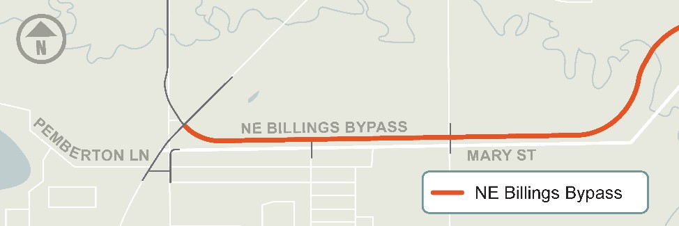
What will happen along Mary Street?
The new roadway will be approximately 130 feet north (centerline to centerline) of Mary Street, with access to Mary Street at Bitterroot Drive and Hawthorne Lane. See the graphic below for a visual of where the new roadway will be located.
The City of Billings currently classifies Mary Street as a principal arterial. With the development of this project, the City of Billings is expected to reclassify Mary Street as a “local” road. Mary Street can be expected to operate like today, as a local road providing direct access to the nearby homes.
As part of the reconstruction of the Main Street, US 87, Old Highway 312, and the new urban arterial road intersection, Mary Street will be reconnected to Bench Boulevard. Access to Main Street from Bench Boulevard will be via Pemberton Lane to enhance safety.
Will there be drainage/flooding impacts?
The design of the roadway’s drainage considers how the roadway will impact pre-construction drainage conditions. The drainage design minimizes impacts to existing drainage patterns while focusing on preventing flooding to adjacent properties and structures.
Will there be impact to groundwater levels?
Roadside ditches are designed to convey surface drainage above groundwater levels to prevent changes to groundwater levels. Any existing groundwater drainage channels affected by the new roadway will be reconstructed to continue collecting and transmitting groundwater.
Will I be able to bike or walk along the Billings Bypass?
Yes, you can bike and walk along the new road. Nearly all Montana roads, excluding the urban freeways, are generally considered open to bicycle and pedestrian traffic, either directly on the street, road shoulders, or sidewalks. A 10-foot shared-use path has been constructed on the Yellowstone River Bridge.
Will the traffic noise be a disturbance?
Traffic noise was studied for this project. Noise receptors measured the current noise levels within approximately 500 feet of the roadway alignment. Expected future noise levels were then modeled using nationally defined noise analysis methods. Based on the analyses conducted, the change in ambient noise isn’t enough to require noise mitigation measures (see EIS Section 4.3.8.2.3). Information about specific areas along the alignment is available in the EIS document.
Will trucks be able to use the new arterial roadway?
The new road will accommodate all modes of transportation. One of the project’s goals is to improve access and mobility in the eastern area of Billings and to improve connectivity between I-90 and Old Hwy 312/US 87.